Mao (Mao)
The Dominican city of Santa Cruz de Mao, or simply Mao, is the head municipality of the Valverde province, in the northwest of the country.
It is the largest city of the Dominican northwest and the centre of the region. Its name, a Taíno word, comes from the River Mao, near the city. Its nickname is Ciudad de los Bellos Atardeceres (English, "City of the Beautiful Sunsets"); this was given by Juan De Jesus Reyes, renowned poet and Dominican literary icon. There are no mountains to the west of the city and it is common to see a "red" sky at sunset; it is a very dry region and there is much dust in the air which gives the sky a red color.
For most of its history, the region was called "El Despoblado"; that means a region without any population, because it is a very dry region and agriculture was not possible.
When the governor of the Spanish colony gave the order in 1606 that everybody living on the northern coast had to move inland, some people came to live around the present Mao. They had cattle that were raised in hatos. "Hato" means a large farm for raising cattle (a ranch), and so the names of many places around Mao derive from the word: Hatico, Hato del Yaque, Hato Nuevo, Hato Viejo, Hato del Medio.
The town of Mao was built close to where the River Mao flows into the River Yaque del Norte. The first Catholic church was built in 1869.
The town was made a Puesto Cantonal (an old category similar to the present Municipal District under a military government). Mao was elevated to the category of municipality in 1882, and in 1904 its official name was changed to "Valverde" after José Desiderio Valverde, former President of the Dominican Republic. Because the name Mao was known by everybody and Valverde was a new name, people called the city "Valverde (Mao)", and it is still common to say so.
When the province was created in 1959, Mao was made its head municipality and provincial capital.
Map - Mao (Mao)
Map


Country - Dominican_Republic
 |
 |
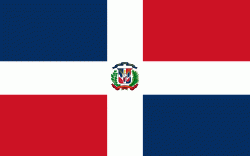
| Flag of the Dominican Republic | |
The native Taíno people had inhabited Hispaniola before the arrival of Europeans, dividing it into five chiefdoms. They had constructed an advanced farming and hunting society, and were in the process of becoming an organized civilization. The Taínos also inhabited Cuba, Jamaica, Puerto Rico, and the Bahamas. The Genoese mariner Christopher Columbus explored and claimed the island for Castile, landing there on his first voyage in 1492. The colony of Santo Domingo became the site of the first permanent European settlement in the Americas and the first seat of Spanish colonial rule in the New World. It would also become the site to introduce importations of enslaved Africans to the Americas. In 1697, Spain recognized French dominion over the western third of the island, which became the independent state of Haiti in 1804.
Currency / Language
| ISO | Currency | Symbol | Significant figures |
|---|---|---|---|
| DOP | Dominican peso | $ | 2 |
| ISO | Language |
|---|---|
| ES | Spanish language |